


col de peyrefiche

gadafo
User
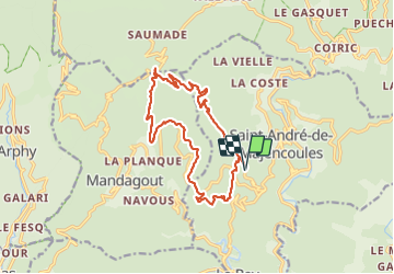

Length
16 km

Max alt
833 m

Uphill gradient
674 m
Km-Effort
25 km

Min alt
272 m

Downhill gradient
673 m
Boucle
Yes
Creation date :
2021-09-07 07:24:02.944
Updated on :
2021-09-07 13:38:59.289
6h13
Difficulty : Medium

FREE GPS app for hiking
 SityTrail
IGN / Geographical institutes
SityTrail Plus
The world is yours!
About
Trail Walking of 16 km to be discovered at Occitania, Gard, Saint-André-de-Majencoules. This trail is proposed by gadafo.
Positioning
Country:
France
Region :
Occitania
Department/Province :
Gard
Municipality :
Saint-André-de-Majencoules
Location:
Unknown
Start:(Dec)
Start:(UTM)
553252 ; 4874719 (31T) N.
Comments