


Ardèche jour quatre

ezola
User
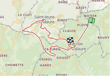

Length
19.4 km

Max alt
1123 m

Uphill gradient
815 m
Km-Effort
31 km

Min alt
491 m

Downhill gradient
913 m
Boucle
No
Creation date :
2021-09-07 07:15:12.0
Updated on :
2021-09-07 14:39:44.674
5h03
Difficulty : Very difficult

FREE GPS app for hiking
 SityTrail
IGN / Geographical institutes
SityTrail Plus
The world is yours!
About
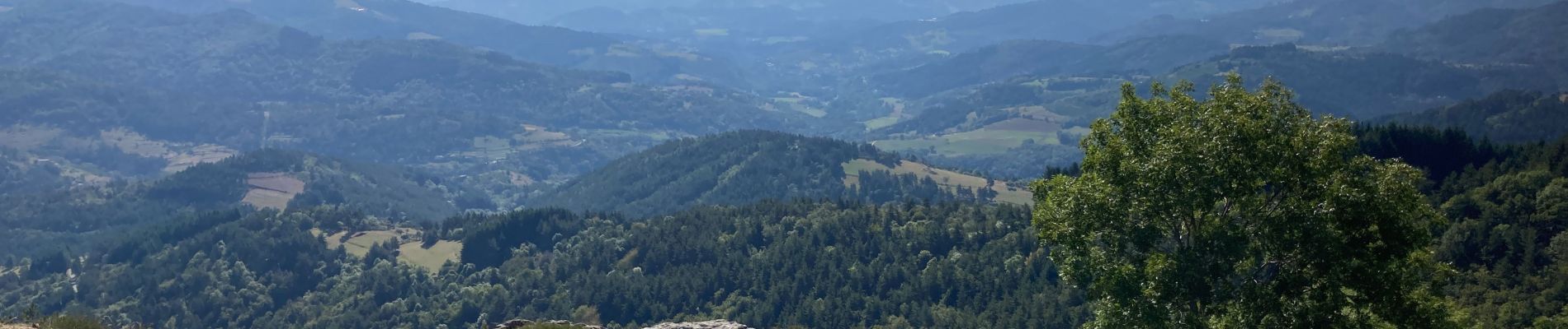
Trail Walking of 19.4 km to be discovered at Auvergne-Rhône-Alpes, Ardèche, Labatie-d'Andaure. This trail is proposed by ezola.
Photos

Positioning
Country:
France
Region :
Auvergne-Rhône-Alpes
Department/Province :
Ardèche
Municipality :
Labatie-d'Andaure
Location:
Unknown
Start:(Dec)
Start:(UTM)
618645 ; 4988530 (31T) N.
Comments