


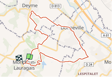
Montbrun Donneville Deyme fait 2021

pidjam
User

Length
11.5 km

Max alt
282 m

Uphill gradient
306 m
Km-Effort
15.5 km

Min alt
163 m

Downhill gradient
304 m
Boucle
Yes
Creation date :
2021-09-09 06:27:40.76
Updated on :
2021-09-09 09:28:58.298
3h00
Difficulty : Medium

FREE GPS app for hiking
 SityTrail
IGN / Geographical institutes
SityTrail Plus
The world is yours!
About
Trail Walking of 11.5 km to be discovered at Occitania, Haute-Garonne, Montbrun-Lauragais. This trail is proposed by pidjam.
Positioning
Country:
France
Region :
Occitania
Department/Province :
Haute-Garonne
Municipality :
Montbrun-Lauragais
Location:
Unknown
Start:(Dec)
Start:(UTM)
380529 ; 4812672 (31T) N.
Comments