


Tete de la Frema depart Fouilouse 1311+

claude nier
User

Length
18.1 km

Max alt
3121 m

Uphill gradient
1311 m
Km-Effort
36 km

Min alt
1914 m

Downhill gradient
1305 m
Boucle
Yes
Creation date :
2021-09-09 13:35:37.197
Updated on :
2021-09-09 13:37:06.767
8h05
Difficulty : Very difficult

FREE GPS app for hiking
 SityTrail
IGN / Geographical institutes
SityTrail Plus
The world is yours!
About
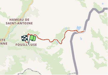
Trail Walking of 18.1 km to be discovered at Provence-Alpes-Côte d'Azur, Alpes-de-Haute-Provence, Saint-Paul-sur-Ubaye. This trail is proposed by claude nier.
Description
rando faite a l armee 11Eme Bca Jausiers
refaite et toujours aussi sympa
Positioning
Country:
France
Region :
Provence-Alpes-Côte d'Azur
Department/Province :
Alpes-de-Haute-Provence
Municipality :
Saint-Paul-sur-Ubaye
Location:
Unknown
Start:(Dec)
Start:(UTM)
325667 ; 4932615 (32T) N.
Comments