


05 nevache lac rond

trietsch
User
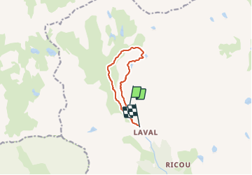

Length
8.3 km

Max alt
2466 m

Uphill gradient
396 m
Km-Effort
13.7 km

Min alt
2021 m

Downhill gradient
456 m
Boucle
No
Creation date :
2021-09-05 08:21:20.0
Updated on :
2021-09-10 09:11:58.997
2h52
Difficulty : Difficult

FREE GPS app for hiking
 SityTrail
IGN / Geographical institutes
SityTrail Plus
The world is yours!
About
Trail Walking of 8.3 km to be discovered at Provence-Alpes-Côte d'Azur, Hautes-Alpes, Névache. This trail is proposed by trietsch.
Positioning
Country:
France
Region :
Provence-Alpes-Côte d'Azur
Department/Province :
Hautes-Alpes
Municipality :
Névache
Location:
Unknown
Start:(Dec)
Start:(UTM)
304769 ; 4993253 (32T) N.
Comments