


JDP 2021

canal
User
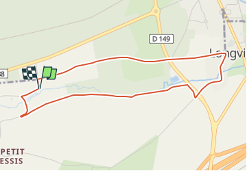

Length
4.6 km

Max alt
116 m

Uphill gradient
42 m
Km-Effort
5.1 km

Min alt
93 m

Downhill gradient
41 m
Boucle
Yes
Creation date :
2021-09-10 12:17:22.722
Updated on :
2021-09-10 12:18:12.444
1h10
Difficulty : Easy

FREE GPS app for hiking
 SityTrail
IGN / Geographical institutes
SityTrail Plus
The world is yours!
About
Trail Walking of 4.6 km to be discovered at Ile-de-France, Yvelines, Longvilliers. This trail is proposed by canal.
Description
Paysage, patrimoine et biodiversité
Positioning
Country:
France
Region :
Ile-de-France
Department/Province :
Yvelines
Municipality :
Longvilliers
Location:
Unknown
Start:(Dec)
Start:(UTM)
423747 ; 5380779 (31U) N.
Comments