


Jastres Nord

pb07
User

Length
2.7 km

Max alt
320 m

Uphill gradient
126 m
Km-Effort
4.3 km

Min alt
194 m

Downhill gradient
126 m
Boucle
Yes
Creation date :
2021-09-10 16:40:40.895
Updated on :
2021-09-10 18:37:53.792
1h37
Difficulty : Easy

FREE GPS app for hiking
 SityTrail
IGN / Geographical institutes
SityTrail Plus
The world is yours!
About
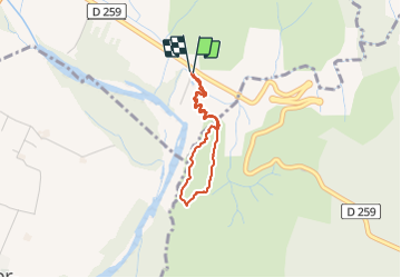
Trail Walking of 2.7 km to be discovered at Auvergne-Rhône-Alpes, Ardèche, Saint-Privat. This trail is proposed by pb07.
Positioning
Country:
France
Region :
Auvergne-Rhône-Alpes
Department/Province :
Ardèche
Municipality :
Saint-Privat
Location:
Unknown
Start:(Dec)
Start:(UTM)
613642 ; 4941688 (31T) N.
Comments