


Belledonne Croix de Cassini

c.gourme
User
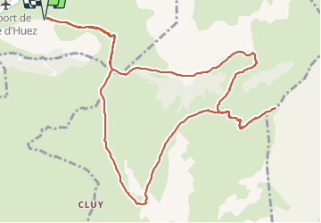

Length
14.5 km

Max alt
2361 m

Uphill gradient
1014 m
Km-Effort
28 km

Min alt
1647 m

Downhill gradient
1014 m
Boucle
Yes
Creation date :
2021-09-11 07:04:32.0
Updated on :
2021-09-12 19:34:08.372
5h51
Difficulty : Medium

FREE GPS app for hiking
 SityTrail
IGN / Geographical institutes
SityTrail Plus
The world is yours!
About
Trail Walking of 14.5 km to be discovered at Auvergne-Rhône-Alpes, Isère, Huez. This trail is proposed by c.gourme.
Positioning
Country:
France
Region :
Auvergne-Rhône-Alpes
Department/Province :
Isère
Municipality :
Huez
Location:
Unknown
Start:(Dec)
Start:(UTM)
271126 ; 4996598 (32T) N.
Comments