


Nîmes le v

Bwattier
User
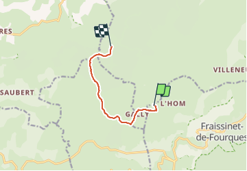

Length
6.9 km

Max alt
1156 m

Uphill gradient
104 m
Km-Effort
8.4 km

Min alt
1081 m

Downhill gradient
123 m
Boucle
No
Creation date :
2021-09-12 08:59:15.045
Updated on :
2021-09-12 12:23:11.971
2h24
Difficulty : Medium

FREE GPS app for hiking
 SityTrail
IGN / Geographical institutes
SityTrail Plus
The world is yours!
About
Trail Walking of 6.9 km to be discovered at Occitania, Lozère, Fraissinet-de-Fourques. This trail is proposed by Bwattier.
Positioning
Country:
France
Region :
Occitania
Department/Province :
Lozère
Municipality :
Fraissinet-de-Fourques
Location:
Unknown
Start:(Dec)
Start:(UTM)
540291 ; 4896937 (31T) N.
Comments