


Plateau des lacs

ezorzet
User
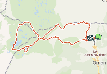

Length
15.8 km

Max alt
2074 m

Uphill gradient
805 m
Km-Effort
27 km

Min alt
1390 m

Downhill gradient
813 m
Boucle
Yes
Creation date :
2021-09-12 05:51:00.06
Updated on :
2021-09-19 08:31:35.008
7h19
Difficulty : Difficult

FREE GPS app for hiking
 SityTrail
IGN / Geographical institutes
SityTrail Plus
The world is yours!
About
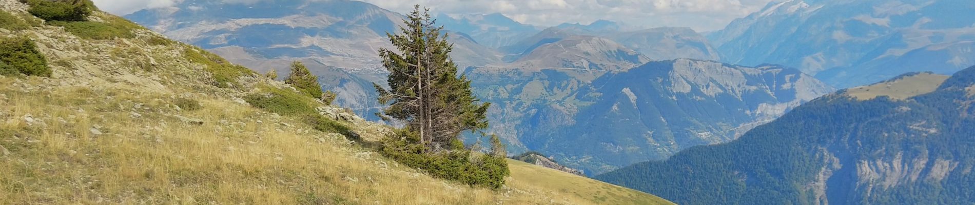
Trail Walking of 15.8 km to be discovered at Auvergne-Rhône-Alpes, Isère, Ornon. This trail is proposed by ezorzet.
Description
Plateau des lacs Ornon
Photos


Positioning
Country:
France
Region :
Auvergne-Rhône-Alpes
Department/Province :
Isère
Municipality :
Ornon
Location:
Unknown
Start:(Dec)
Start:(UTM)
734180 ; 4993481 (31T) N.
Comments