


La Grésière à partir des Gallands - Menglon

Philindy26
User


4h00
Difficulty : Difficult

FREE GPS app for hiking
 SityTrail
IGN / Geographical institutes
SityTrail Plus
The world is yours!
About
Trail Walking of 11.2 km to be discovered at Auvergne-Rhône-Alpes, Drôme, Menglon. This trail is proposed by Philindy26.
Description
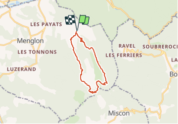
Départ du Hameau des Gallands, commune de Menglon...
Géolocalisation (Google Maps) : https://goo.gl/maps/F6mJbEaMEJwxPL5v7
Prendre le GR 91 au sud en direction du col de Pinet (1199 m) par Gaude et le Tunnel.
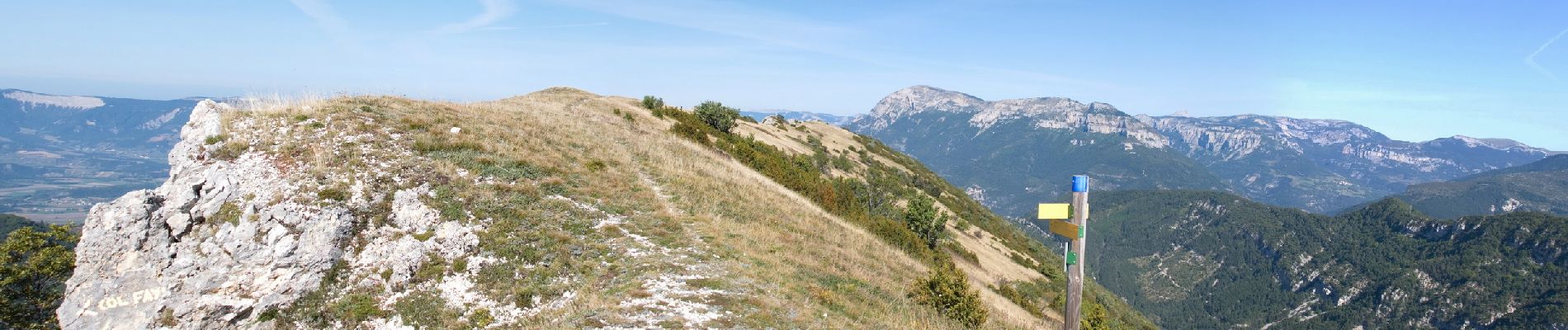
Au col de Pinet, monter directement sur la Grésière (1493 m).
Retour par le Col du Fays (1302 m) et le Col de Mian (1133 m)...
Photos


62 photos in total. Please click on a photo to see them all in the gallery.
Positioning
Comments