


38 les vans

ericf64
User
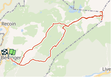

Length
13.3 km

Max alt
2439 m

Uphill gradient
918 m
Km-Effort
26 km

Min alt
1783 m

Downhill gradient
917 m
Boucle
Yes
Creation date :
2021-09-13 06:43:03.418
Updated on :
2021-09-13 16:01:59.543
6h40
Difficulty : Medium

FREE GPS app for hiking
 SityTrail
IGN / Geographical institutes
SityTrail Plus
The world is yours!
About
Trail Walking of 13.3 km to be discovered at Auvergne-Rhône-Alpes, Isère, Chamrousse. This trail is proposed by ericf64.
Description
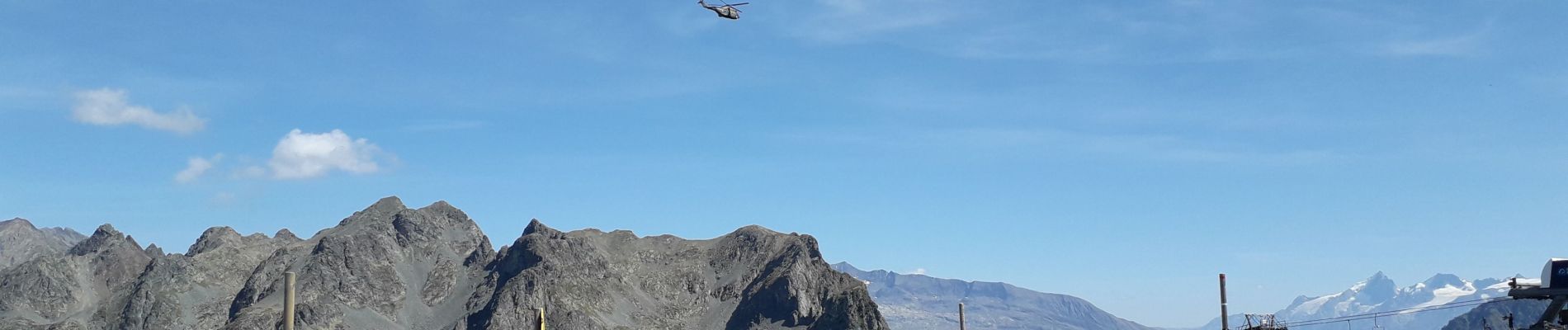
monte par lac Achard aux Vans ( petit et grand ) decente pour la Croix de Chamrousse
Photos

Positioning
Country:
France
Region :
Auvergne-Rhône-Alpes
Department/Province :
Isère
Municipality :
Chamrousse
Location:
Unknown
Start:(Dec)
Start:(UTM)
726429 ; 4999458 (31T) N.
Comments