


GR_559_AC_03_Fontenu_Bonlieu_20210914

patrickdanilo
User
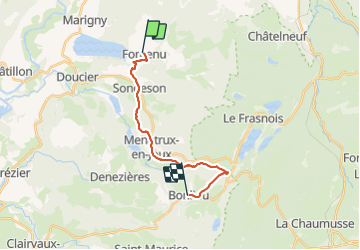

Length
15.4 km

Max alt
822 m

Uphill gradient
512 m
Km-Effort
22 km

Min alt
530 m

Downhill gradient
321 m
Boucle
No
Creation date :
2021-09-14 07:29:21.388
Updated on :
2022-02-09 10:47:16.373
4h51
Difficulty : Difficult

FREE GPS app for hiking
 SityTrail
IGN / Geographical institutes
SityTrail Plus
The world is yours!
About
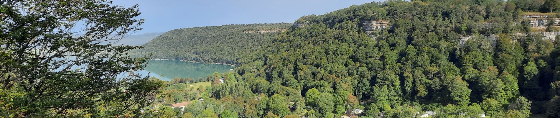
Trail Walking of 15.4 km to be discovered at Bourgogne-Franche-Comté, Jura, Fontenu. This trail is proposed by patrickdanilo.
Description
GR®559
Le Jura d'Ouest en Est
de Montaigu (Jura) Bourgogne-Franche-Comté
aux Rousses (Jura) Bourgogne-Franche-Comté
82,8km
Photos


Positioning
Country:
France
Region :
Bourgogne-Franche-Comté
Department/Province :
Jura
Municipality :
Fontenu
Location:
Unknown
Start:(Dec)
Start:(UTM)
715927 ; 5172119 (31T) N.
Comments