


GR_559_AE_05_Grande-Riviere-Chateau_Hauts-Bienne_20210918

patrickdanilo
User
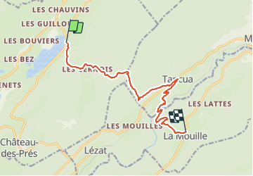

Length
11.9 km

Max alt
1109 m

Uphill gradient
552 m
Km-Effort
19.2 km

Min alt
622 m

Downhill gradient
516 m
Boucle
No
Creation date :
2021-09-18 08:01:01.775
Updated on :
2022-02-09 10:47:57.686
4h05
Difficulty : Very difficult

FREE GPS app for hiking
 SityTrail
IGN / Geographical institutes
SityTrail Plus
The world is yours!
About
Trail Walking of 11.9 km to be discovered at Bourgogne-Franche-Comté, Jura, Grande-Rivière-Château. This trail is proposed by patrickdanilo.
Description
GR®559
Le Jura d'Ouest en Est
de Montaigu (Jura) Bourgogne-Franche-Comté
aux Rousses (Jura) Bourgogne-Franche-Comté
82,8km
Photos


Positioning
Country:
France
Region :
Bourgogne-Franche-Comté
Department/Province :
Jura
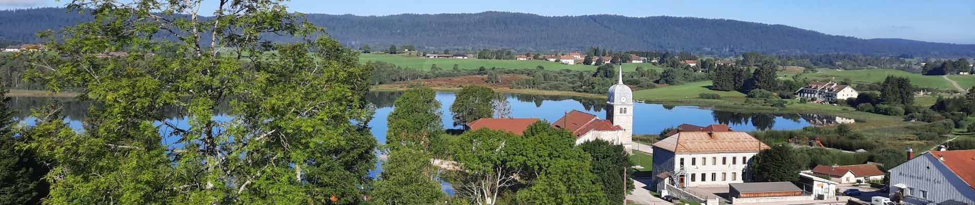
Municipality :
Grande-Rivière-Château
Location:
Grande-Rivière
Start:(Dec)
Start:(UTM)
724033 ; 5157626 (31T) N.
Comments