


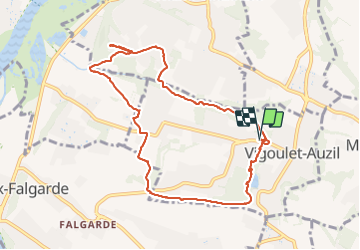
Vigoulet Ramade Pontoise

pidjam
User

Length
9.9 km

Max alt
259 m

Uphill gradient
263 m
Km-Effort
13.4 km

Min alt
160 m

Downhill gradient
264 m
Boucle
Yes
Creation date :
2021-09-19 07:21:07.541
Updated on :
2021-09-19 10:14:46.285
2h52
Difficulty : Easy

FREE GPS app for hiking
 SityTrail
IGN / Geographical institutes
SityTrail Plus
The world is yours!
About
Trail Walking of 9.9 km to be discovered at Occitania, Haute-Garonne, Vigoulet-Auzil. This trail is proposed by pidjam.
Positioning
Country:
France
Region :
Occitania
Department/Province :
Haute-Garonne
Municipality :
Vigoulet-Auzil
Location:
Unknown
Start:(Dec)
Start:(UTM)
375050 ; 4818488 (31T) N.
Comments