


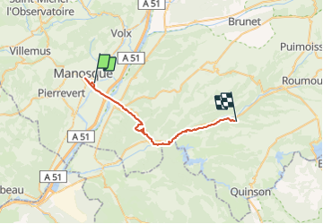
retour Manosque

bernardcornu
User

Length
32 km

Max alt
500 m

Uphill gradient
662 m
Km-Effort
40 km

Min alt
288 m

Downhill gradient
537 m
Boucle
No
Creation date :
2021-09-23 13:07:12.129
Updated on :
2021-09-23 15:26:45.691
1h59
Difficulty : Medium

FREE GPS app for hiking
 SityTrail
IGN / Geographical institutes
SityTrail Plus
The world is yours!
About
Trail Mountain bike of 32 km to be discovered at Provence-Alpes-Côte d'Azur, Alpes-de-Haute-Provence, Manosque. This trail is proposed by bernardcornu.
Positioning
Country:
France
Region :
Provence-Alpes-Côte d'Azur
Department/Province :
Alpes-de-Haute-Provence
Municipality :
Manosque
Location:
Unknown
Start:(Dec)
Start:(UTM)
725150 ; 4855986 (31T) N.
Comments