Trail Walking Augy-sur-Aubois - Compostelle Etape 7  - Photo
 maginot
maginot

User

© OpenStreetMap contributors
Length
Length
21 km
Max alt
Max alt
230 m
Uphill gradient
Uphill gradient
117 m
Km-Effort
Km-Effort  
23 km
Min alt
Min alt
181 m
Downhill gradient
Downhill gradient
111 m
Boucle
Boucle
No
Creation date :
2021-09-26 06:40:34.0
Updated on :
2021-09-26 15:58:17.988

(0 Reviews)

Walking
Walking
5h55
Difficulty : Easy

Scan this QR Code to open this trail in the SityTrail application

FREE GPS app for hiking

Logo SityTrail SityTrail

IGN / Geographical institutes

Download SityTrail from the App Store Download SityTrail from Google Play

Logo SityTrail SityTrail World

The world is yours!

Download SityTrail from the App Store Download SityTrail from Google Play Download SityTrail on Huawei AppGallery

About

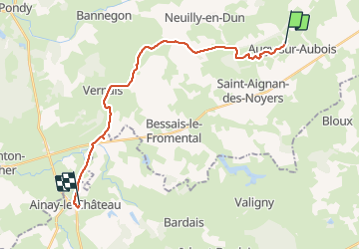
Trail Walking of 21 km to be discovered at Centre-Loire Valley, Cher, Augy-sur-Aubois. This trail is proposed by maginot.

Description

Parcours plat le long du canal Déclassé
Arrive à Ainay le château

Elevation profile

Positioning

Country:
France
Region :
Centre-Loire Valley
Department/Province :
Cher
Municipality :
Augy-sur-Aubois
Location:
Unknown
Start:(UTM)
487657 ; 5181562 (31T) N.

Trails nearby

Trail Trail Saint-Aignan-des-Noyers - st saignant des noyers - Photo
Trail
levequejef

Trail

Easy
Saint-Aignan-des-Noyers, Centre-Loire Valley, Cher, France
23 km | 25 km-effort
2h 59min
Yes


Close
My subscriptions