FFR - la Cime des Colettes

clarambre
User
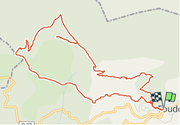

Length
7.9 km

Max alt
1498 m

Uphill gradient
530 m
Km-Effort
15 km

Min alt
984 m

Downhill gradient
533 m
Boucle
Yes
Creation date :
2021-09-28 07:19:04.341
Updated on :
2025-02-06 03:40:58.529
3h23
Difficulty : Difficult

FREE GPS app for hiking
 SityTrail
IGN / Geographical institutes
SityTrail Plus
The world is yours!
About
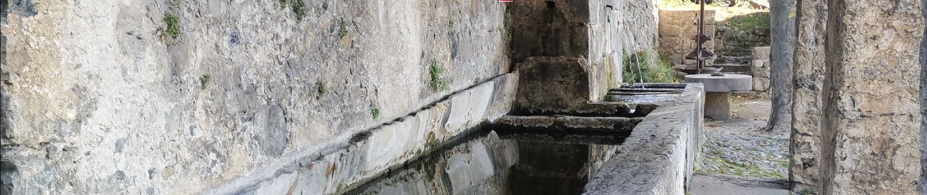
Trail Walking of 7.9 km to be discovered at Provence-Alpes-Côte d'Azur, Maritime Alps, Toudon. This trail is proposed by clarambre.
Photos


Positioning
Country:
France
Region :
Provence-Alpes-Côte d'Azur
Department/Province :
Maritime Alps
Municipality :
Toudon
Location:
Unknown
Start:(Dec)
Start:(UTM)
348410 ; 4862675 (32T) N.
Comments