


Piton de la Fournaise

togolo28
User
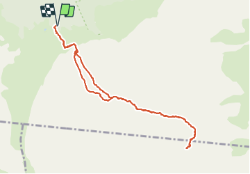

Length
13.9 km

Max alt
2490 m

Uphill gradient
577 m
Km-Effort
22 km

Min alt
2211 m

Downhill gradient
577 m
Boucle
Yes
Creation date :
2021-09-30 02:44:51.914
Updated on :
2021-09-30 08:29:58.118
5h41
Difficulty : Very difficult

FREE GPS app for hiking
 SityTrail
IGN / Geographical institutes
SityTrail Plus
The world is yours!
About
Trail Walking of 13.9 km to be discovered at Réunion, Unknown, Sainte-Rose. This trail is proposed by togolo28.
Positioning
Country:
France
Region :
Réunion
Department/Province :
Unknown
Municipality :
Sainte-Rose
Location:
Unknown
Start:(Dec)
Start:(UTM)
363781 ; 7653237 (40K) S.
Comments