


Le clamas de thubies

laoj
User
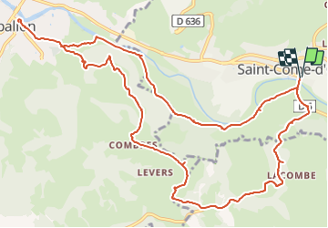

Length
15.6 km

Max alt
564 m

Uphill gradient
363 m
Km-Effort
20 km

Min alt
335 m

Downhill gradient
365 m
Boucle
Yes
Creation date :
2021-09-30 16:50:22.318
Updated on :
2021-09-30 16:52:58.485
4h38
Difficulty : Very difficult

FREE GPS app for hiking
 SityTrail
IGN / Geographical institutes
SityTrail Plus
The world is yours!
About
Trail Walking of 15.6 km to be discovered at Occitania, Aveyron, Saint-Côme-d'Olt. This trail is proposed by laoj.
Description
St come vers espalion retour vallee
Positioning
Country:
France
Region :
Occitania
Department/Province :
Aveyron
Municipality :
Saint-Côme-d'Olt
Location:
Unknown
Start:(Dec)
Start:(UTM)
485446 ; 4928955 (31T) N.
Comments