


2021 Lac blanc

Airelle
User

Length
12.9 km

Max alt
2359 m

Uphill gradient
1179 m
Km-Effort
29 km

Min alt
1416 m

Downhill gradient
1169 m
Boucle
Yes
Creation date :
2021-10-01 07:53:05.0
Updated on :
2021-10-07 18:05:15.287
5h55
Difficulty : Very difficult

FREE GPS app for hiking
 SityTrail
IGN / Geographical institutes
SityTrail Plus
The world is yours!
About
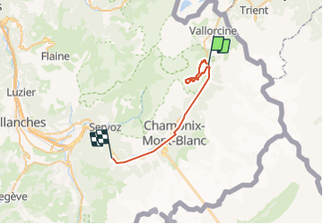
Trail Walking of 12.9 km to be discovered at Auvergne-Rhône-Alpes, Upper Savoy, Chamonix-Mont-Blanc. This trail is proposed by Airelle.
Positioning
Country:
France
Region :
Auvergne-Rhône-Alpes
Department/Province :
Upper Savoy
Municipality :
Chamonix-Mont-Blanc
Location:
Unknown
Start:(Dec)
Start:(UTM)
339385 ; 5095872 (32T) N.
Comments