


dans les Hauts du Menil

margotte
User
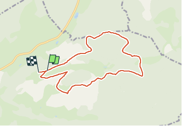

Length
8.5 km

Max alt
993 m

Uphill gradient
337 m
Km-Effort
13 km

Min alt
728 m

Downhill gradient
340 m
Boucle
No
Creation date :
2021-10-02 08:45:04.198
Updated on :
2021-10-02 12:15:45.296
2h11
Difficulty : Easy

FREE GPS app for hiking
 SityTrail
IGN / Geographical institutes
SityTrail Plus
The world is yours!
About
Trail Walking of 8.5 km to be discovered at Grand Est, Vosges, Le Ménil. This trail is proposed by margotte.
Description
balade automnale avec de beaux poitq de vue et de belles forêts.
Positioning
Country:
France
Region :
Grand Est
Department/Province :
Vosges
Municipality :
Le Ménil
Location:
Unknown
Start:(Dec)
Start:(UTM)
336721 ; 5309586 (32T) N.
Comments