


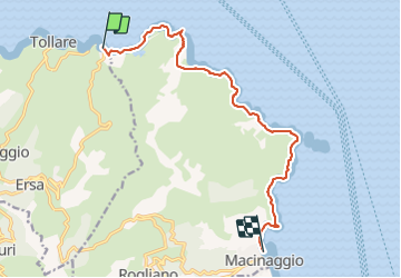
Sentier des douaniers Cap Corse

i20
User

Length
12.5 km

Max alt
122 m

Uphill gradient
283 m
Km-Effort
16.3 km

Min alt
-5 m

Downhill gradient
286 m
Boucle
No
Creation date :
2021-10-02 09:03:10.081
Updated on :
2021-10-02 12:40:55.828
3h37
Difficulty : Medium

FREE GPS app for hiking
 SityTrail
IGN / Geographical institutes
SityTrail Plus
The world is yours!
About
Trail Walking of 12.5 km to be discovered at Corsica, Haute-Corse, Ersa. This trail is proposed by i20.
Positioning
Country:
France
Region :
Corsica
Department/Province :
Haute-Corse
Municipality :
Ersa
Location:
Unknown
Start:(Dec)
Start:(UTM)
532829 ; 4761605 (32T) N.
Comments