Trail Walking Montauroux - Le long de la Siagne du Pont de la Siagne D2562 Bambouseraie - Photo

Le long de la Siagne du Pont de la Siagne D2562 Bambouseraie

 GrouGary
GrouGary

User

© OpenStreetMap contributors
Length
Length
18.3 km
Max alt
Max alt
431 m
Uphill gradient
Uphill gradient
726 m
Km-Effort
Km-Effort  
28 km
Min alt
Min alt
98 m
Downhill gradient
Downhill gradient
728 m
Boucle
Boucle
Yes
Creation date :
2021-10-02 06:22:54.439
Updated on :
2021-10-03 11:41:11.628

(0 Reviews)

Walking
Walking
5h44
Difficulty : Medium

Scan this QR Code to open this trail in the SityTrail application

FREE GPS app for hiking

Logo SityTrail SityTrail

IGN / Geographical institutes

Download SityTrail from the App Store Download SityTrail from Google Play

Logo SityTrail SityTrail World

The world is yours!

Download SityTrail from the App Store Download SityTrail from Google Play Download SityTrail on Huawei AppGallery

About

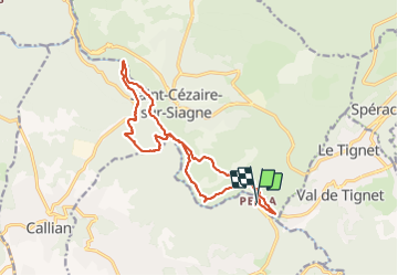
Trail Walking of 18.3 km to be discovered at Provence-Alpes-Côte d'Azur, Var, Montauroux. This trail is proposed by GrouGary.

Description

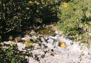
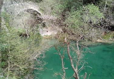
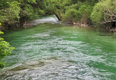
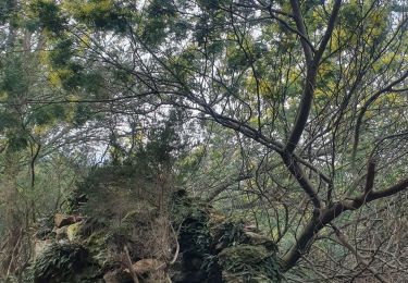
2 boucles : Depart Pont de la Siagne D 2562, Bergeris, Canal de la Siagne, Pont des Tuves, Bois communal du Defens et ses chênes centenaires, les Moulins papeterie de la Siagne, les bords de la Siagne et retour par Chapelle St Saturnin.
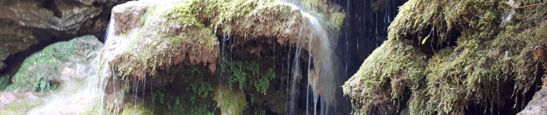
Ombragé, bien pour période chaude. Belles vues sur St Cezaire en rive droite. De belles cascades de mousses et capillaires le long des berges

Elevation profile

Photos

Positioning

Country:
France
Region :
Provence-Alpes-Côte d'Azur
Department/Province :
Var
Municipality :
Montauroux
Location:
Unknown
Start:(UTM)
323912 ; 4832826 (32T) N.

Trails nearby

Trail On foot Tanneron - La chapelle de St Cassien des bois, le pont détruit et au fil de l'eau - Photo
On foot
boulinevelyne

On foot

Easy
(5)
Tanneron, Provence-Alpes-Côte d'Azur, Var, France
7.3 km | 10.3 km-effort
2h 19min
Yes
Trail On foot Le Tignet - Val de Siagne - Photo
On foot
PRO

On foot

Easy
Le Tignet, Provence-Alpes-Côte d'Azur, Maritime Alps, France
6.5 km | 9.5 km-effort
2h 9min
Yes
Trail Walking Saint-Cézaire-sur-Siagne - Col de Cabris - Photo
Walking
jlrayon

Walking

Easy
(1)
Saint-Cézaire-sur-Siagne, Provence-Alpes-Côte d'Azur, Maritime Alps, France
7.3 km | 9.7 km-effort
3h 0min
Yes
Trail Walking Montauroux - Monteroux Gorges de la Siagne 04.04.2015 - Photo
Walking
fredetpascale

Walking

Easy
(1)
Montauroux, Provence-Alpes-Côte d'Azur, Var, France
11.8 km | 16.4 km-effort
3h 26min
Yes
Trail Walking Montauroux - Frankrijk - Lac de St. Cassien - Provence - Photo
Walking
gpstracks

Walking

Very easy
(1)
Montauroux, Provence-Alpes-Côte d'Azur, Var, France
13.5 km | 18.7 km-effort
Unknown
No
Trail Walking Saint-Cézaire-sur-Siagne - st cezaire siagne - Photo
Walking
pjjrevrard

Walking

Very easy
(1)
Saint-Cézaire-sur-Siagne, Provence-Alpes-Côte d'Azur, Maritime Alps, France
6.9 km | 11.4 km-effort
2h 42min
No
Trail Walking Saint-Cézaire-sur-Siagne - Le canal et la rivière de la Siagne  - Photo
Walking
Palimpseste

Walking

Medium
Saint-Cézaire-sur-Siagne, Provence-Alpes-Côte d'Azur, Maritime Alps, France
8.4 km | 13.9 km-effort
3h 8min
Yes
Trail Walking Tanneron - 2024-02-16 Tanneron Mimosas - Photo
Walking
GUIDE
Kargil

Walking

Medium
Tanneron, Provence-Alpes-Côte d'Azur, Var, France
11.1 km | 17.8 km-effort
4h 2min
Yes
Trail Mountain bike Tanneron - autour de tanneron - Photo
Mountain bike
papamorse

Mountain bike

Very difficult
(1)
Tanneron, Provence-Alpes-Côte d'Azur, Var, France
30 km | 41 km-effort
2h 50min
Yes


Close
My subscriptions