Trail Walking Auby - boucle des 3 cavaliers départ Auby - Photo

boucle des 3 cavaliers départ Auby

 janfil
janfil

User

© OpenStreetMap contributors
Length
Length
23 km
Max alt
Max alt
51 m
Uphill gradient
Uphill gradient
120 m
Km-Effort
Km-Effort  
25 km
Min alt
Min alt
18 m
Downhill gradient
Downhill gradient
120 m
Boucle
Boucle
Yes
Creation date :
2021-10-04 12:36:57.475
Updated on :
2021-10-04 14:44:01.249

(1 Reviews)

Walking
Walking
6h06
Difficulty : Very difficult

Scan this QR Code to open this trail in the SityTrail application

FREE GPS app for hiking

Logo SityTrail SityTrail

IGN / Geographical institutes

Download SityTrail from the App Store Download SityTrail from Google Play

Logo SityTrail SityTrail World

The world is yours!

Download SityTrail from the App Store Download SityTrail from Google Play Download SityTrail on Huawei AppGallery

About

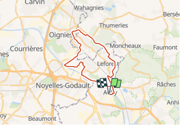
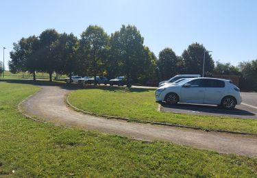
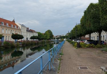
Trail Walking of 23 km to be discovered at Hauts-de-France, Nord, Auby. This trail is proposed by janfil.

Description

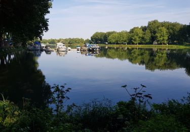
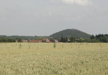
très belle promenade le long des terrils.
Pas mal de boue dans la partie sud ouest après une grosse pluie.

Elevation profile

Photos

Positioning

Country:
France
Region :
Hauts-de-France
Department/Province :
Nord
Municipality :
Auby
Location:
Unknown
Start:(UTM)
504298 ; 5584444 (31U) N.

Comments

Please log in to post a review or rate the element


Trails nearby

Trail Walking Roost-Warendin - Roost Warendint : Escarpelle et Paturelle - Photo
Walking
dehemjacques

Walking

Medium
(1)
Roost-Warendin, Hauts-de-France, Nord, France
10.9 km | 12.7 km-effort
2h 47min
Yes
Trail Walking Auby - boucle Auby - Port d'eau Courcelles-lès-Lens - Photo
Walking
janfil

Walking

Medium
Auby, Hauts-de-France, Nord, France
10.1 km | 10.8 km-effort
2h 10min
Yes
Trail Nordic walking Leforest - ostricourt - Photo
Nordic walking
ancar

Nordic walking

Very easy
(1)
Leforest, Hauts-de-France, Pas-de-Calais, France
6.6 km | 7.7 km-effort
1h 26min
Yes
Trail Walking Moncheaux - Circuit de Moncheaux - Photo
Walking
tracegps

Walking

Medium
Moncheaux, Hauts-de-France, Nord, France
11.1 km | 12.2 km-effort
2h 45min
Yes
Trail Mountain bike Leforest - La boucle des trois cavaliers - Leforest - Photo
Mountain bike
tracegps

Mountain bike

Medium
(1)
Leforest, Hauts-de-France, Pas-de-Calais, France
21 km | 23 km-effort
2h 0min
Yes
Trail Walking Leforest - La boucle des trois cavaliers - Leforest - Photo
Walking
tracegps

Walking

Very difficult
(3)
Leforest, Hauts-de-France, Pas-de-Calais, France
21 km | 23 km-effort
5h 19min
Yes
Trail Walking Roost-Warendin - Raches  - Photo
Walking
Morelli

Walking

Very difficult
Roost-Warendin, Hauts-de-France, Nord, France
25 km | 26 km-effort
6h 0min
Yes
Trail Walking Douai - Douai Courchelette A/R par la scarpe - Photo
Walking
BrassensJC

Walking

Difficult
Douai, Hauts-de-France, Nord, France
11.4 km | 12.3 km-effort
2h 25min
Yes
Trail Walking Douai - Les canaux de Dorignies -Douai - Photo
Walking
tracegps

Walking

Medium
Douai, Hauts-de-France, Nord, France
11.1 km | 12 km-effort
2h 49min
Yes


Close
My subscriptions