L'Huveaune-Nans les pins-06-10-21

Christiancordin
User
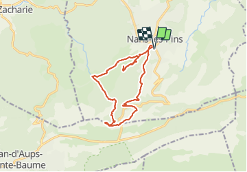

Length
15.4 km

Max alt
706 m

Uphill gradient
639 m
Km-Effort
24 km

Min alt
394 m

Downhill gradient
638 m
Boucle
Yes
Creation date :
2021-10-06 07:11:56.609
Updated on :
2021-10-07 15:00:13.675
5h26
Difficulty : Medium

FREE GPS app for hiking
 SityTrail
IGN / Geographical institutes
SityTrail Plus
The world is yours!
About
Trail On foot of 15.4 km to be discovered at Provence-Alpes-Côte d'Azur, Var, Nans-les-Pins. This trail is proposed by Christiancordin.
Description
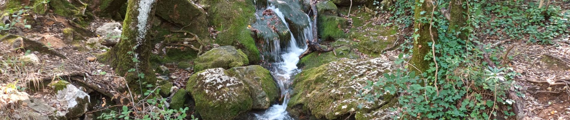
Nans les Pins-le vieux Nans-Ste croix-Mantelette-source de l'Huveaune-grotte Castelette-Chemin des Rois.
Photos


Positioning
Country:
France
Region :
Provence-Alpes-Côte d'Azur
Department/Province :
Var
Municipality :
Nans-les-Pins
Location:
Unknown
Start:(Dec)
Start:(UTM)
725554 ; 4805594 (31T) N.
Comments