Trail Walking Chaumont - 2021-10-08 Le Vuache en boucle - Photo

2021-10-08 Le Vuache en boucle

© OpenStreetMap contributors
Length
Length
11.1 km
Max alt
Max alt
1100 m
Uphill gradient
Uphill gradient
629 m
Km-Effort
Km-Effort  
19.5 km
Min alt
Min alt
510 m
Downhill gradient
Downhill gradient
630 m
Boucle
Boucle
Yes
Creation date :
2021-10-08 08:36:45.731
Updated on :
2021-10-09 16:30:54.242

(0 Reviews)

Walking
Walking
4h49
Difficulty : Medium

Scan this QR Code to open this trail in the SityTrail application

FREE GPS app for hiking

Logo SityTrail SityTrail

IGN / Geographical institutes

Download SityTrail from the App Store Download SityTrail from Google Play

Logo SityTrail SityTrail World

The world is yours!

Download SityTrail from the App Store Download SityTrail from Google Play Download SityTrail on Huawei AppGallery

About

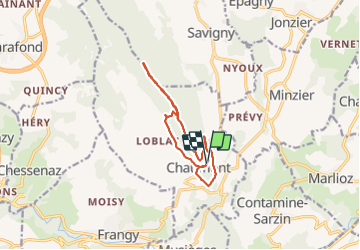
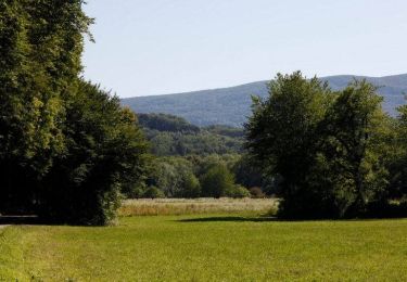
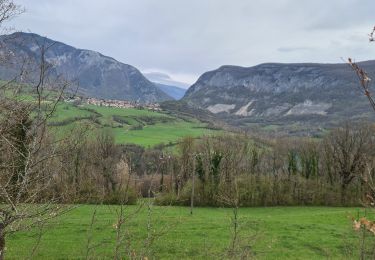
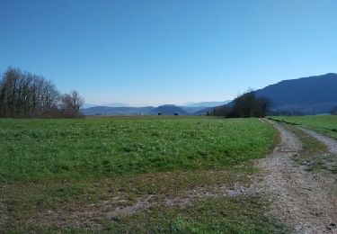
Trail Walking of 11.1 km to be discovered at Auvergne-Rhône-Alpes, Upper Savoy, Chaumont. This trail is proposed by patpounet73.

Description

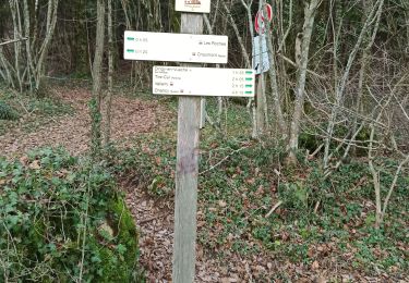
Rando agréable pouvant être réalisée en famille. Balisage clair et bien réalisé.
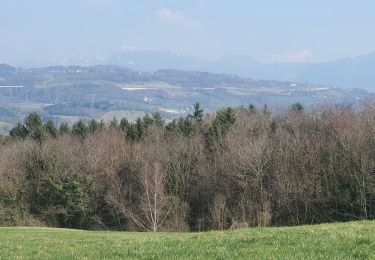
Seul regret, peu de point de vue coté Ain et lac Léman.

Elevation profile

Positioning

Country:
France
Region :
Auvergne-Rhône-Alpes
Department/Province :
Upper Savoy
Municipality :
Chaumont
Location:
Unknown
Start:(UTM)
729060 ; 5102314 (31T) N.

Trails nearby

Trail Walking Musièges - Musiège - Photo
Walking
crocau

Walking

Medium
Musièges, Auvergne-Rhône-Alpes, Upper Savoy, France
5.5 km | 7.5 km-effort
1h 26min
Yes
Trail Walking Marlioz - 22-03-2022 Marlioz - Les Usses - Photo
Walking
GUIDE
Kargil

Walking

Medium
Marlioz, Auvergne-Rhône-Alpes, Upper Savoy, France
22 km | 28 km-effort
4h 36min
Yes
Trail Walking Contamine-Sarzin - Contamine Sarzin Cascade Barbannaz - Photo
Walking
Petitchaperonvert

Walking

Medium
Contamine-Sarzin, Auvergne-Rhône-Alpes, Upper Savoy, France
8.6 km | 13.8 km-effort
2h 49min
Yes
Trail Walking Frangy - Sur les Pas des Huguenots - Frangy - Chancy - Photo
Walking
tracegps

Walking

Difficult
Frangy, Auvergne-Rhône-Alpes, Upper Savoy, France
22 km | 29 km-effort
6h 0min
No
Trail Walking Clarafond-Arcine - Entre Nant et Rhône  - Photo
Walking
Jean-Paulchoux

Walking

Medium
Clarafond-Arcine, Auvergne-Rhône-Alpes, Upper Savoy, France
14.2 km | 21 km-effort
5h 46min
Yes
Trail Walking Clarafond-Arcine - sainte Victoire - Photo
Walking
Manuel Vergara

Walking

Easy
Clarafond-Arcine, Auvergne-Rhône-Alpes, Upper Savoy, France
8.8 km | 14.2 km-effort
3h 19min
Yes
Trail Walking Chaumont - Chaumont - Photo
Walking
Manuel Vergara

Walking

Very easy
Chaumont, Auvergne-Rhône-Alpes, Upper Savoy, France
8.3 km | 11.3 km-effort
2h 20min
Yes
Trail Walking Frangy - De Frangy à Chaumont  - Photo
Walking
COMAN

Walking

Medium
Frangy, Auvergne-Rhône-Alpes, Upper Savoy, France
12.2 km | 17.3 km-effort
4h 47min
Yes
Trail Walking Jonzier-Épagny - Epagny sentier nature - Photo
Walking
COMAN

Walking

Easy
(1)
Jonzier-Épagny, Auvergne-Rhône-Alpes, Upper Savoy, France
9.7 km | 12.6 km-effort
2h 51min
Yes


Close
My subscriptions