


villas colmars

cmaymard
User
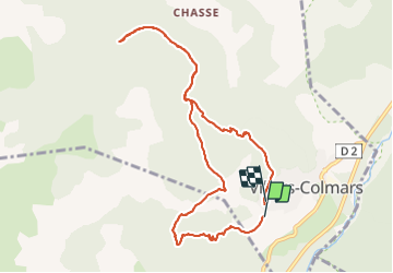

Length
11.2 km

Max alt
1706 m

Uphill gradient
454 m
Km-Effort
17.2 km

Min alt
1328 m

Downhill gradient
437 m
Boucle
Yes
Creation date :
2021-10-08 12:26:02.76
Updated on :
2021-10-08 18:54:20.201
6h25
Difficulty : Difficult

FREE GPS app for hiking
 SityTrail
IGN / Geographical institutes
SityTrail Plus
The world is yours!
About
Trail Walking of 11.2 km to be discovered at Provence-Alpes-Côte d'Azur, Alpes-de-Haute-Provence, Villars-Colmars. This trail is proposed by cmaymard.
Positioning
Country:
France
Region :
Provence-Alpes-Côte d'Azur
Department/Province :
Alpes-de-Haute-Provence
Municipality :
Villars-Colmars
Location:
Unknown
Start:(Dec)
Start:(UTM)
307879 ; 4892762 (32T) N.
Comments