


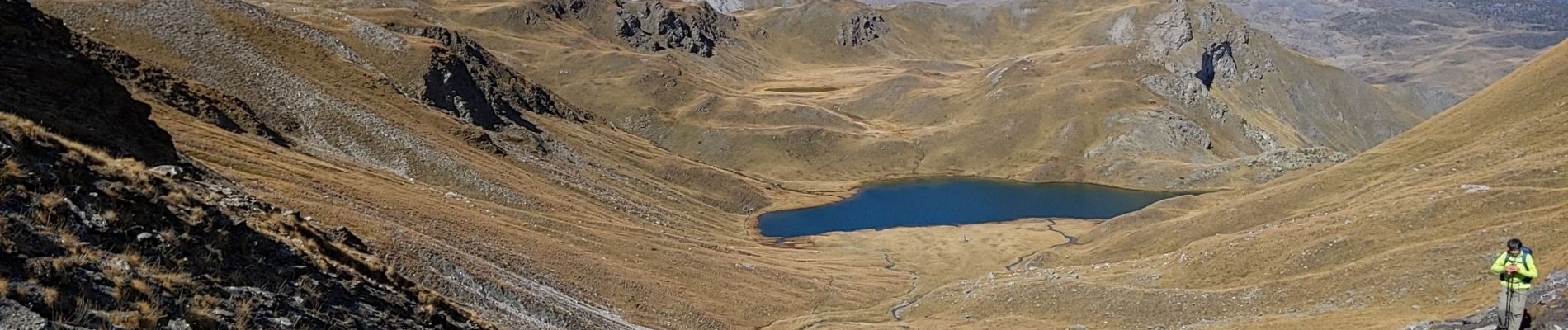
lac des cordes 8 10 21

bymarc26
User
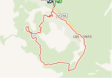

Length
11.6 km

Max alt
2599 m

Uphill gradient
688 m
Km-Effort
21 km

Min alt
1959 m

Downhill gradient
688 m
Boucle
Yes
Creation date :
2021-10-08 07:57:37.093
Updated on :
2021-10-09 07:14:40.792
3h34
Difficulty : Medium

FREE GPS app for hiking
 SityTrail
IGN / Geographical institutes
SityTrail Plus
The world is yours!
About
Trail Walking of 11.6 km to be discovered at Provence-Alpes-Côte d'Azur, Hautes-Alpes, Cervières. This trail is proposed by bymarc26.
Photos


Positioning
Country:
France
Region :
Provence-Alpes-Côte d'Azur
Department/Province :
Hautes-Alpes
Municipality :
Cervières
Location:
Unknown
Start:(Dec)
Start:(UTM)
326225 ; 4969361 (32T) N.
Comments