Trail Walking Puiseux-Pontoise - chaussée Jules cesar - Photo
 unirega
unirega

User

© OpenStreetMap contributors
Length
Length
6.8 km
Max alt
Max alt
117 m
Uphill gradient
Uphill gradient
131 m
Km-Effort
Km-Effort  
8.6 km
Min alt
Min alt
44 m
Downhill gradient
Downhill gradient
134 m
Boucle
Boucle
Yes
Creation date :
2021-10-09 10:17:05.955
Updated on :
2021-10-12 13:46:51.969

(0 Reviews)

Walking
Walking
1h51
Difficulty : Medium

Scan this QR Code to open this trail in the SityTrail application

FREE GPS app for hiking

Logo SityTrail SityTrail

IGN / Geographical institutes

Download SityTrail from the App Store Download SityTrail from Google Play

Logo SityTrail SityTrail World

The world is yours!

Download SityTrail from the App Store Download SityTrail from Google Play Download SityTrail on Huawei AppGallery

About

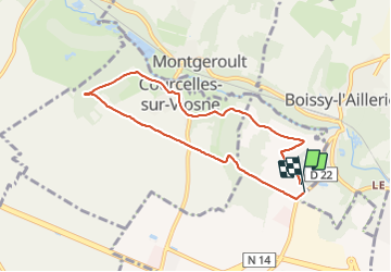
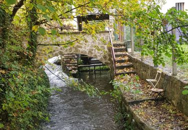
Trail Walking of 6.8 km to be discovered at Ile-de-France, Val-d'Oise, Puiseux-Pontoise. This trail is proposed by unirega.

Description

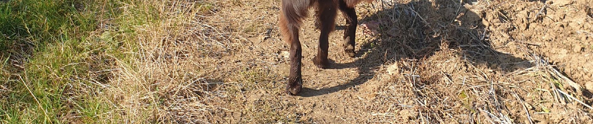
Balade tranquille avec chien. Juste 400m de village. Pas de point d'eau pour le chien sur le parcours. Mélange de plaines et sous-bois.

Elevation profile

Photos

Positioning

Country:
France
Region :
Ile-de-France
Department/Province :
Val-d'Oise
Municipality :
Puiseux-Pontoise
Location:
Unknown
Start:(UTM)
428623 ; 5435502 (31U) N.

Trails nearby

Trail Running Cergy - Les Bords de l'Oise et la Passerelle de l'Axe Majeur - Port Cergy - Photo
Running
tracegps

Running

Easy
(1)
Cergy, Ile-de-France, Val-d'Oise, France
5.2 km | 5.8 km-effort
30min
Yes
Trail On foot Cergy - LES BALADES DE L’ÉTÉ # 9 / DE L’AXE MAJEUR À PORT CERGY - Photo
On foot
Vadim

On foot

Very easy
(1)
Cergy, Ile-de-France, Val-d'Oise, France
6 km | 7.4 km-effort
1h 45min
Yes
Trail On foot Cergy - Le Fil d'Ariane - Photo
On foot
PRO

On foot

Easy
Cergy, Ile-de-France, Val-d'Oise, France
3.2 km | 3.7 km-effort
50min
No
Trail On foot Cergy - Bords d'Oise Eragny - Port Cergy - Photo
On foot
Vadim

On foot

Very easy
(1)
Cergy, Ile-de-France, Val-d'Oise, France
8 km | 8.7 km-effort
2h 0min
Yes
Trail Walking Neuville-sur-Oise - base losir cergy  - Photo
Walking
bertrandgeffroy

Walking

Medium
(1)
Neuville-sur-Oise, Ile-de-France, Val-d'Oise, France
22 km | 26 km-effort
5h 35min
No
Trail Walking Us - US - La chaussée Brunehaut - Photo
Walking
marcel.F

Walking

Easy
(1)
Us, Ile-de-France, Val-d'Oise, France
11 km | 13 km-effort
2h 50min
Yes
Trail Walking Boissy-l'Aillerie - La chaussée Jules César - Photo
Walking
ppeul

Walking

Very easy
(2)
Boissy-l'Aillerie, Ile-de-France, Val-d'Oise, France
10.9 km | 13.9 km-effort
Unknown
Yes
Trail Walking Osny - Osny chateau chateau Groussy - Photo
Walking
avdem

Walking

Easy
Osny, Ile-de-France, Val-d'Oise, France
11.1 km | 12.9 km-effort
3h 3min
Yes
Trail Walking Boissy-l'Aillerie - Bois l'Artillerie. Boucle de Courmonbois - Photo
Walking
avdem

Walking

Difficult
(1)
Boissy-l'Aillerie, Ile-de-France, Val-d'Oise, France
11.5 km | 13.3 km-effort
2h 42min
Yes


Close
My subscriptions