


capee2

Patrick Castagne
User
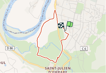

Length
3.3 km

Max alt
172 m

Uphill gradient
17 m
Km-Effort
3.6 km

Min alt
166 m

Downhill gradient
18 m
Boucle
Yes
Creation date :
2021-10-09 12:13:39.322
Updated on :
2021-10-09 13:20:10.703
1h06
Difficulty : Easy

FREE GPS app for hiking
 SityTrail
IGN / Geographical institutes
SityTrail Plus
The world is yours!
About
Trail Walking of 3.3 km to be discovered at Occitania, Aveyron, Capdenac-Gare. This trail is proposed by Patrick Castagne.
Positioning
Country:
France
Region :
Occitania
Department/Province :
Aveyron
Municipality :
Capdenac-Gare
Location:
Unknown
Start:(Dec)
Start:(UTM)
426615 ; 4935157 (31T) N.
Comments