


St donat

brigitBB26
User

Length
19.8 km

Max alt
324 m

Uphill gradient
320 m
Km-Effort
24 km

Min alt
189 m

Downhill gradient
298 m
Boucle
No
Creation date :
2021-10-10 08:22:35.948
Updated on :
2021-10-10 11:00:17.007
2h36
Difficulty : Easy

FREE GPS app for hiking
 SityTrail
IGN / Geographical institutes
SityTrail Plus
The world is yours!
About
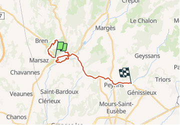
Trail Walking of 19.8 km to be discovered at Auvergne-Rhône-Alpes, Drôme, Saint-Donat-sur-l'Herbasse. This trail is proposed by brigitBB26.
Positioning
Country:
France
Region :
Auvergne-Rhône-Alpes
Department/Province :
Drôme
Municipality :
Saint-Donat-sur-l'Herbasse
Location:
Unknown
Start:(Dec)
Start:(UTM)
654714 ; 4997984 (31T) N.
Comments