


gy chene moreau

lecmic
User
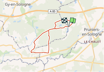

Length
12.3 km

Max alt
102 m

Uphill gradient
93 m
Km-Effort
13.5 km

Min alt
75 m

Downhill gradient
93 m
Boucle
Yes
Creation date :
2021-10-12 06:52:59.076
Updated on :
2021-10-12 09:27:50.602
2h34
Difficulty : Very easy

FREE GPS app for hiking
 SityTrail
IGN / Geographical institutes
SityTrail Plus
The world is yours!
About
Trail Nordic walking of 12.3 km to be discovered at Centre-Loire Valley, Loir-et-Cher, Pruniers-en-Sologne. This trail is proposed by lecmic.
Description
marche nordique
Positioning
Country:
France
Region :
Centre-Loire Valley
Department/Province :
Loir-et-Cher
Municipality :
Pruniers-en-Sologne
Location:
Unknown
Start:(Dec)
Start:(UTM)
397540 ; 5242291 (31T) N.
Comments