


Sourcieux

daniellebou
User
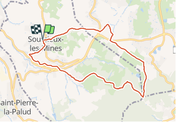

Length
9.4 km

Max alt
509 m

Uphill gradient
335 m
Km-Effort
13.9 km

Min alt
325 m

Downhill gradient
338 m
Boucle
Yes
Creation date :
2021-10-12 06:56:43.533
Updated on :
2021-10-12 09:49:24.177
2h51
Difficulty : Difficult

FREE GPS app for hiking
 SityTrail
IGN / Geographical institutes
SityTrail Plus
The world is yours!
About
Trail Walking of 9.4 km to be discovered at Auvergne-Rhône-Alpes, Rhône, Sourcieux-les-Mines. This trail is proposed by daniellebou.
Positioning
Country:
France
Region :
Auvergne-Rhône-Alpes
Department/Province :
Rhône
Municipality :
Sourcieux-les-Mines
Location:
Unknown
Start:(Dec)
Start:(UTM)
626036 ; 5073675 (31T) N.
Comments
belle balade ombragée. Avec de beaux paysages.