


issambres

clintest
User

Length
14.6 km

Max alt
237 m

Uphill gradient
529 m
Km-Effort
22 km

Min alt
17 m

Downhill gradient
524 m
Boucle
Yes
Creation date :
2021-10-13 07:24:38.57
Updated on :
2021-10-13 13:15:21.888
5h50
Difficulty : Very difficult

FREE GPS app for hiking
 SityTrail
IGN / Geographical institutes
SityTrail Plus
The world is yours!
About
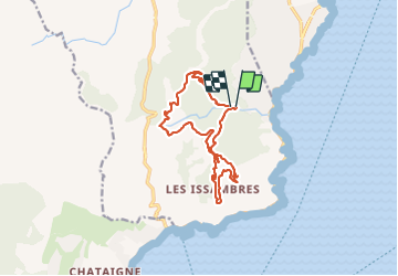
Trail Walking of 14.6 km to be discovered at Provence-Alpes-Côte d'Azur, Var, Roquebrune-sur-Argens. This trail is proposed by clintest.
Positioning
Country:
France
Region :
Provence-Alpes-Côte d'Azur
Department/Province :
Var
Municipality :
Roquebrune-sur-Argens
Location:
Unknown
Start:(Dec)
Start:(UTM)
313774 ; 4804338 (32T) N.
Comments