


mennetou sur cher

lecmic
User
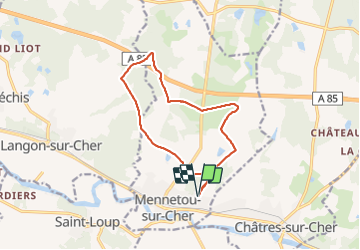

Length
12.1 km

Max alt
133 m

Uphill gradient
86 m
Km-Effort
13.2 km

Min alt
106 m

Downhill gradient
86 m
Boucle
Yes
Creation date :
2021-10-13 12:04:58.594
Updated on :
2021-10-13 14:46:18.074
2h40
Difficulty : Easy

FREE GPS app for hiking
 SityTrail
IGN / Geographical institutes
SityTrail Plus
The world is yours!
About
Trail Walking of 12.1 km to be discovered at Centre-Loire Valley, Loir-et-Cher, Mennetou-sur-Cher. This trail is proposed by lecmic.
Description
le chateau d'eau
Positioning
Country:
France
Region :
Centre-Loire Valley
Department/Province :
Loir-et-Cher
Municipality :
Mennetou-sur-Cher
Location:
Unknown
Start:(Dec)
Start:(UTM)
415082 ; 5235975 (31T) N.
Comments