


Sentier Denecourt 1

guydu41
User


1h50
Difficulty : Easy

FREE GPS app for hiking
 SityTrail
IGN / Geographical institutes
SityTrail Plus
The world is yours!
About
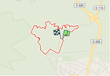
Trail Walking of 4 km to be discovered at Ile-de-France, Seine-et-Marne, Fontainebleau. This trail is proposed by guydu41.
Description
Très beau circuit balisé bleu parmi de spectaculaires chaos rocheux.
Le parcours débute par la traversée de la Plaine puis de la Vallée de la Chambre en passant à côté d'une belle sculpture en bois puis d'une fontaine avant d'aborder le circuit tortueux des Rochers du Mont Ussy avec de nombreux passages étroits entre rochers, à côté de grottes, traversée de cavernes, cheminement le long de parois rocheuses, sur des crêtes avec plusieurs points de vue, etc.
Départ/Arrivée : Parking du Mont Ussy, Route du Mont Ussy, 77300 Fontainebleau
Photos


26 photos in total. Please click on a photo to see them all in the gallery.
Positioning
Comments