


Vins sur Caramy-15-10-21

Christiancordin
User
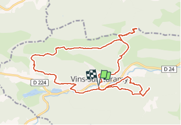

Length
14.6 km

Max alt
390 m

Uphill gradient
477 m
Km-Effort
21 km

Min alt
186 m

Downhill gradient
475 m
Boucle
Yes
Creation date :
2021-10-15 07:11:21.237
Updated on :
2021-10-16 15:56:13.463
4h54
Difficulty : Medium

FREE GPS app for hiking
 SityTrail
IGN / Geographical institutes
SityTrail Plus
The world is yours!
About
Trail Walking of 14.6 km to be discovered at Provence-Alpes-Côte d'Azur, Var, Vins-sur-Caramy. This trail is proposed by Christiancordin.
Description
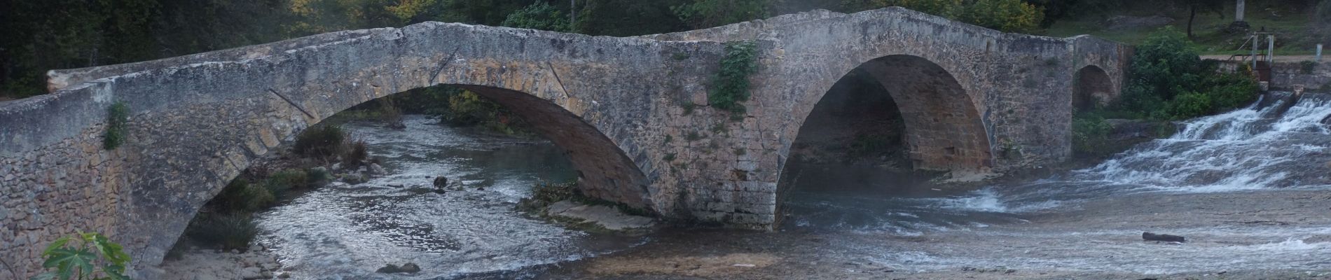
Pont médiéval-grotte des résistants-Caramy- passerelle-GR 653A (chemin de Compostelle)-chapelle St Vincent-château vieux-Ste Suzanne-chemin St Vincent-château de Vins.
Photos


Positioning
Country:
France
Region :
Provence-Alpes-Côte d'Azur
Department/Province :
Var
Municipality :
Vins-sur-Caramy
Location:
Unknown
Start:(Dec)
Start:(UTM)
268702 ; 4812769 (32T) N.
Comments