


G3 lac d'Isaby cabane estibere

LouisROGER
User GUIDE
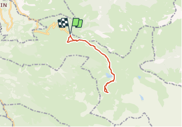

Length
11 km

Max alt
1814 m

Uphill gradient
464 m
Km-Effort
17.2 km

Min alt
1558 m

Downhill gradient
463 m
Boucle
Yes
Creation date :
2021-10-15 07:47:30.459
Updated on :
2021-10-15 16:57:15.827
5h56
Difficulty : Difficult

FREE GPS app for hiking
 SityTrail
IGN / Geographical institutes
SityTrail Plus
The world is yours!
About
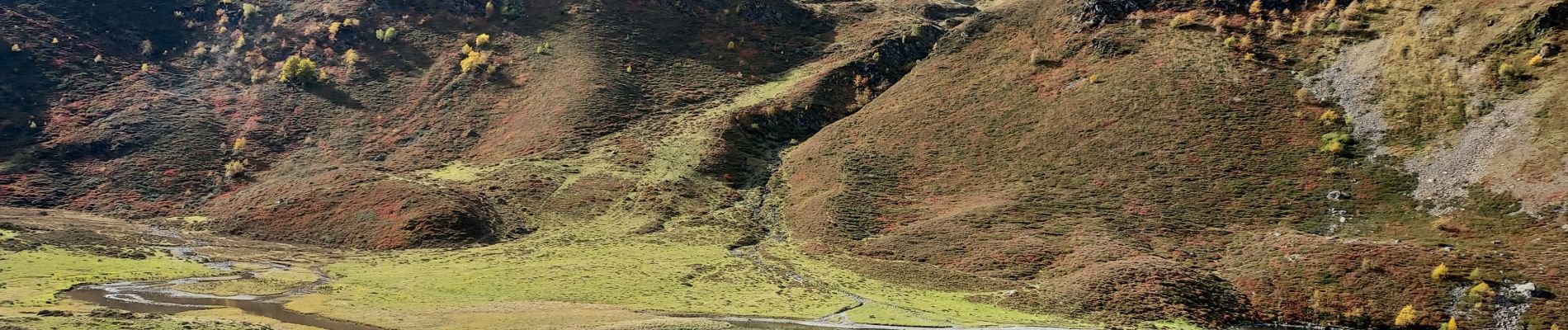
Trail Walking of 11 km to be discovered at Occitania, Hautespyrenees, Beaucens. This trail is proposed by LouisROGER.
Photos


Positioning
Country:
France
Region :
Occitania
Department/Province :
Hautespyrenees
Municipality :
Beaucens
Location:
Unknown
Start:(Dec)
Start:(UTM)
744388 ; 4762055 (30T) N.
Comments