


BARGY: GRAND BARGY

djeepee74
User
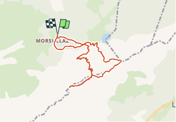

Length
9.8 km

Max alt
2295 m

Uphill gradient
1226 m
Km-Effort
26 km

Min alt
1224 m

Downhill gradient
1227 m
Boucle
Yes
Creation date :
2021-10-16 07:06:21.78
Updated on :
2021-10-23 15:48:12.412
7h00
Difficulty : Very difficult

FREE GPS app for hiking
 SityTrail
IGN / Geographical institutes
SityTrail Plus
The world is yours!
About
Trail Walking of 9.8 km to be discovered at Auvergne-Rhône-Alpes, Upper Savoy, Mont-Saxonnex. This trail is proposed by djeepee74.
Description
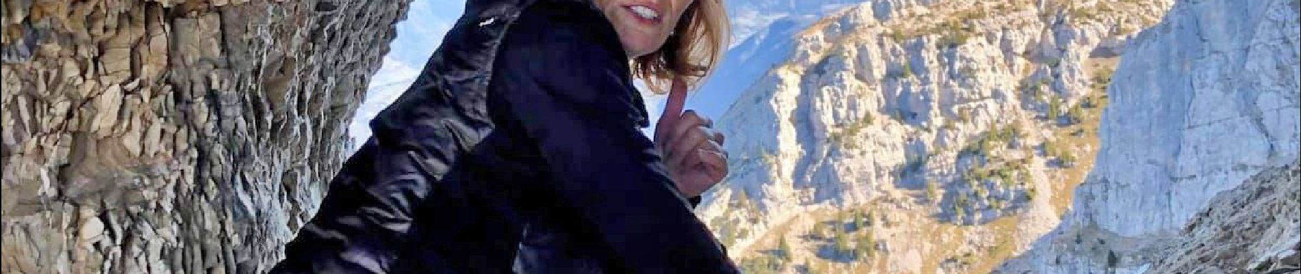
BOUCLE... live 20211015
encadrée par "Les Rando Climbers" avec Karine Daguenet: "Riche expérience, tracé impressionnant nécessitant un pied sûr... attention aux chutes de pierres."
Photos


Positioning
Country:
France
Region :
Auvergne-Rhône-Alpes
Department/Province :
Upper Savoy
Municipality :
Mont-Saxonnex
Location:
Unknown
Start:(Dec)
Start:(UTM)
305568 ; 5100265 (32T) N.
Comments