


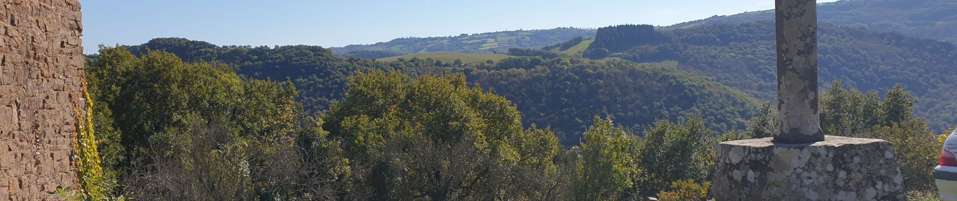
brousse le chateau

CASSISFRAMBOISE
User
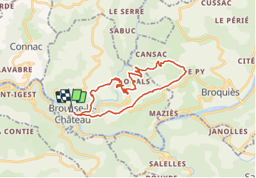

Length
16.5 km

Max alt
543 m

Uphill gradient
597 m
Km-Effort
24 km

Min alt
241 m

Downhill gradient
592 m
Boucle
Yes
Creation date :
2021-10-17 07:16:25.874
Updated on :
2021-10-17 13:48:47.535
4h28
Difficulty : Medium

FREE GPS app for hiking
 SityTrail
IGN / Geographical institutes
SityTrail Plus
The world is yours!
About
Trail Walking of 16.5 km to be discovered at Occitania, Aveyron, Brousse-le-Château. This trail is proposed by CASSISFRAMBOISE.
Photos


Positioning
Country:
France
Region :
Occitania
Department/Province :
Aveyron
Municipality :
Brousse-le-Château
Location:
Unknown
Start:(Dec)
Start:(UTM)
469769 ; 4871686 (31T) N.
Comments