


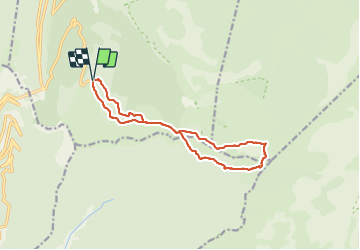
Rando ASPTT Pas des Econdus Pas de Chabrinel

TOULAUDIN
User

Length
13.6 km

Max alt
1719 m

Uphill gradient
715 m
Km-Effort
23 km

Min alt
1379 m

Downhill gradient
711 m
Boucle
Yes
Creation date :
2021-10-17 07:53:17.291
Updated on :
2021-11-16 11:59:17.013
6h20
Difficulty : Difficult

FREE GPS app for hiking
 SityTrail
IGN / Geographical institutes
SityTrail Plus
The world is yours!
About
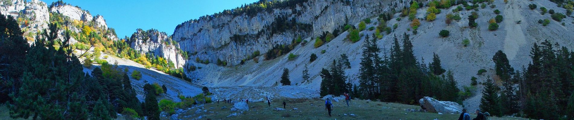
Trail Walking of 13.6 km to be discovered at Auvergne-Rhône-Alpes, Drôme, Saint-Agnan-en-Vercors. This trail is proposed by TOULAUDIN.
Description
trace enregistrée. Attention Hors sentier sur le Plateau
longue descente par le pas des écondus -350M et remontée assez raide au pas de Chabrinel
Photos


Positioning
Country:
France
Region :
Auvergne-Rhône-Alpes
Department/Province :
Drôme
Municipality :
Saint-Agnan-en-Vercors
Location:
Unknown
Start:(Dec)
Start:(UTM)
691539 ; 4968295 (31T) N.
Comments