


Sentier Denecourt 7

guydu41
User


2h37
Difficulty : Medium

FREE GPS app for hiking
 SityTrail
IGN / Geographical institutes
SityTrail Plus
The world is yours!
About
Trail Walking of 6.7 km to be discovered at Ile-de-France, Seine-et-Marne, Fontainebleau. This trail is proposed by guydu41.
Description
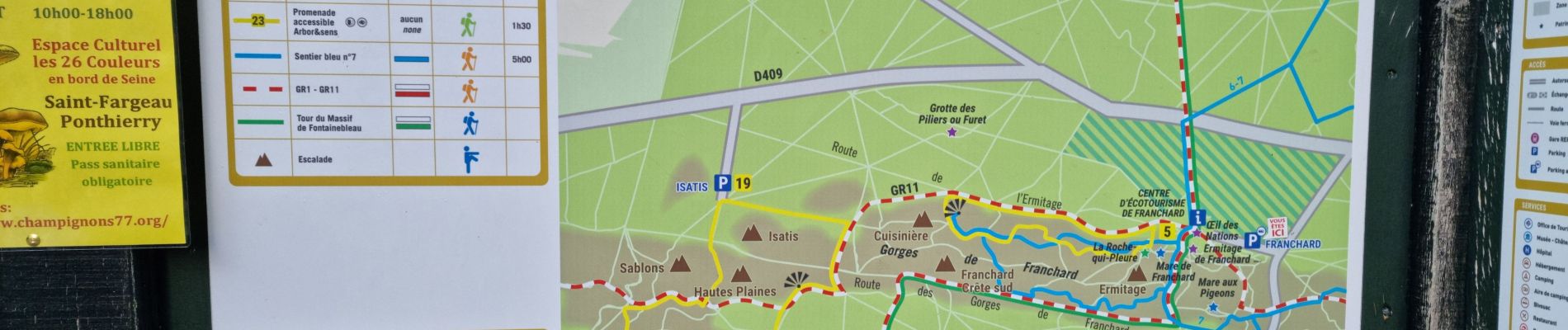
Circuit en grande partie sur le sentier Denecourt 7 balisé bleu.
Il se prolonge un peu au-delà du point de vue pour descendre vers le GR11 par un chemin escarpé et revenir par un long escalier en bois .
Ce parcours parmi de nombreux chaos rocheux spectaculaires emprunte plusieurs passages étroits, tortueux, relativement escarpés, souterrains, à côté de cavités, grottes, points de vue, etc.
Note : Les bâtons de marche ne sont pas obligatoires mais conseillés pour certaines personnes.
Départ/arrivée : parking des Gorges de Franchard, 1 route de l'Ermitage, 77300 Fontainebleau
Photos


54 photos in total. Please click on a photo to see them all in the gallery.
Positioning
Comments