


raccourci autour du mont Touleur, Larochemillay

martinjacque
User
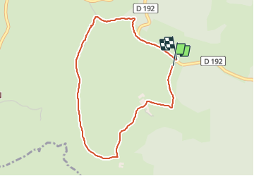

Length
4 km

Max alt
460 m

Uphill gradient
127 m
Km-Effort
5.7 km

Min alt
339 m

Downhill gradient
125 m
Boucle
Yes
Creation date :
2021-10-19 12:23:38.736
Updated on :
2021-10-19 14:16:40.995
1h52
Difficulty : Easy

FREE GPS app for hiking
 SityTrail
IGN / Geographical institutes
SityTrail Plus
The world is yours!
About
Trail Walking of 4 km to be discovered at Bourgogne-Franche-Comté, Nièvre, Larochemillay. This trail is proposed by martinjacque.
Description
Très belle balade. Derniers 500m qui grimpent
Positioning
Country:
France
Region :
Bourgogne-Franche-Comté
Department/Province :
Nièvre
Municipality :
Larochemillay
Location:
Unknown
Start:(Dec)
Start:(UTM)
574281 ; 5193310 (31T) N.
Comments