


Taillefer par le crêtes et Pyramide

c.gourme
User
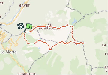

Length
17.1 km

Max alt
2851 m

Uphill gradient
1480 m
Km-Effort
37 km

Min alt
1652 m

Downhill gradient
1484 m
Boucle
Yes
Creation date :
2021-10-19 06:20:34.0
Updated on :
2021-10-20 18:55:45.577
7h33
Difficulty : Difficult

FREE GPS app for hiking
 SityTrail
IGN / Geographical institutes
SityTrail Plus
The world is yours!
About
Trail Walking of 17.1 km to be discovered at Auvergne-Rhône-Alpes, Isère, La Morte. This trail is proposed by c.gourme.
Description
Attention gros névés en descendant il faut des crampons de forestiers meme en octobre !
Positioning
Country:
France
Region :
Auvergne-Rhône-Alpes
Department/Province :
Isère
Municipality :
La Morte
Location:
Unknown
Start:(Dec)
Start:(UTM)
726234 ; 4992161 (31T) N.
Comments