


SityTrail - Rocamadour

houbart
User
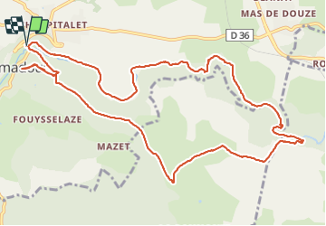

Length
13.9 km

Max alt
329 m

Uphill gradient
298 m
Km-Effort
17.8 km

Min alt
139 m

Downhill gradient
298 m
Boucle
Yes
Creation date :
2021-10-21 11:20:06.545
Updated on :
2021-10-23 07:34:11.048
4h02
Difficulty : Difficult

FREE GPS app for hiking
 SityTrail
IGN / Geographical institutes
SityTrail Plus
The world is yours!
About
Trail Walking of 13.9 km to be discovered at Occitania, Lot, Rocamadour. This trail is proposed by houbart.
Description
Vue sur Rocamadour à la croix de Cufelle. Moulins en ruines sur l'Alzou.
Photos


Positioning
Country:
France
Region :
Occitania
Department/Province :
Lot
Municipality :
Rocamadour
Location:
Unknown
Start:(Dec)
Start:(UTM)
391019 ; 4961887 (31T) N.
Comments