


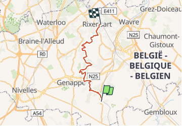
De Villers la ville à Rixensart

pasvraimec
User

Length
30 km

Max alt
153 m

Uphill gradient
522 m
Km-Effort
37 km

Min alt
77 m

Downhill gradient
532 m
Boucle
No
Creation date :
2021-10-22 11:14:10.793
Updated on :
2021-10-22 11:15:07.212
8h24
Difficulty : Difficult

FREE GPS app for hiking
 SityTrail
IGN / Geographical institutes
SityTrail Plus
The world is yours!
About
Trail On foot of 30 km to be discovered at Wallonia, Walloon Brabant, Villers-la-Ville. This trail is proposed by pasvraimec.
Description
Balade de Philippe et Gaëlle
Positioning
Country:
Belgium
Region :
Wallonia
Department/Province :
Walloon Brabant
Municipality :
Villers-la-Ville
Location:
Villers-la-Ville
Start:(Dec)
Start:(UTM)
608590 ; 5604017 (31U) N.
Comments