


Nevache col du Chardonnet

c.gourme
User

Length
12.8 km

Max alt
2637 m

Uphill gradient
788 m
Km-Effort
23 km

Min alt
1863 m

Downhill gradient
784 m
Boucle
Yes
Creation date :
2021-10-27 06:57:51.0
Updated on :
2021-10-27 17:00:16.837
6h03
Difficulty : Medium

FREE GPS app for hiking
 SityTrail
IGN / Geographical institutes
SityTrail Plus
The world is yours!
About
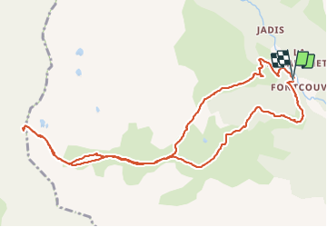
Trail Walking of 12.8 km to be discovered at Provence-Alpes-Côte d'Azur, Hautes-Alpes, Névache. This trail is proposed by c.gourme.
Positioning
Country:
France
Region :
Provence-Alpes-Côte d'Azur
Department/Province :
Hautes-Alpes
Municipality :
Névache
Location:
Unknown
Start:(Dec)
Start:(UTM)
306630 ; 4989683 (32T) N.
Comments