


Tour du Charmant Som par Chamechine

GOHIER
User
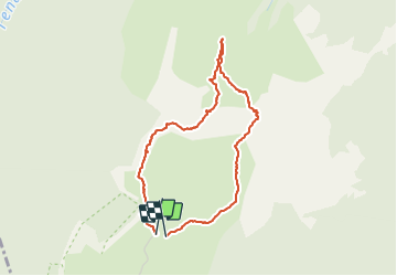

Length
4 km

Max alt
1857 m

Uphill gradient
263 m
Km-Effort
7.5 km

Min alt
1631 m

Downhill gradient
264 m
Boucle
Yes
Creation date :
2021-10-28 09:17:50.0
Updated on :
2021-10-28 13:00:25.301
3h06
Difficulty : Difficult

FREE GPS app for hiking
 SityTrail
IGN / Geographical institutes
SityTrail Plus
The world is yours!
About
Trail Walking of 4 km to be discovered at Auvergne-Rhône-Alpes, Isère, Saint-Pierre-de-Chartreuse. This trail is proposed by GOHIER.
Description
Depuis les bergeries. Passages un peu exposés et vertigineux. Temps humide proscrit.
Vu des chamois!
Positioning
Country:
France
Region :
Auvergne-Rhône-Alpes
Department/Province :
Isère
Municipality :
Saint-Pierre-de-Chartreuse
Location:
Unknown
Start:(Dec)
Start:(UTM)
716049 ; 5022081 (31T) N.
Comments