


RETORD: TOUR DU PLATEAU

djeepee74
User
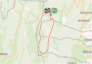

Length
12.7 km

Max alt
1280 m

Uphill gradient
247 m
Km-Effort
16 km

Min alt
1164 m

Downhill gradient
246 m
Boucle
Yes
Creation date :
2021-10-28 09:35:34.975
Updated on :
2021-10-28 15:47:05.878
3h30
Difficulty : Easy

FREE GPS app for hiking
 SityTrail
IGN / Geographical institutes
SityTrail Plus
The world is yours!
About
Trail Walking of 12.7 km to be discovered at Auvergne-Rhône-Alpes, Ain, Valserhône. This trail is proposed by djeepee74.
Description
BOUCLE... live 20211028.
Le Raimont - Cuvery - Ferme du Retord - La Grange à Lucien - Le Tumet - Pra Devant
Positioning
Country:
France
Region :
Auvergne-Rhône-Alpes
Department/Province :
Ain
Municipality :
Valserhône
Location:
Châtillon-en-Michaille
Start:(Dec)
Start:(UTM)
711368 ; 5110035 (31T) N.
Comments